Tag: Remote travel destinations

  • Through the Canadian Rockies – A Rocky Mountaineer Luxury Train Journey From Vancouver to Jasper

    Through the Canadian Rockies – A Rocky Mountaineer Luxury Train Journey From Vancouver to Jasper

    Pic by: http://www.rockymountaineer.com

    By Wandernests Dispatch – Travel Nest I 24 Nov, 2025

    Embarking on the Rocky Mountaineer luxury train journey is not simply a way to travel through the Canadian Rockies – it is an experience of slow, scenic indulgence. From the moment you board, the Rocky Mountaineer luxury train journey wraps you in panoramic glass-domed views, gourmet dining and attentive hospitality designed to honor every mile of wilderness. Unlike ordinary rail trips, the Rocky Mountaineer luxury train journey is engineered for daylight travel only, so not a single canyon, glacier, or wildlife sighting is missed. Every curve, river crossing, and mountain pass is intentional, transforming the Rocky Mountaineer luxury train journey into a moving theatre of Canada’s most majestic landscapes.


    Why This Route Exists – A Railroad That Built a Nation

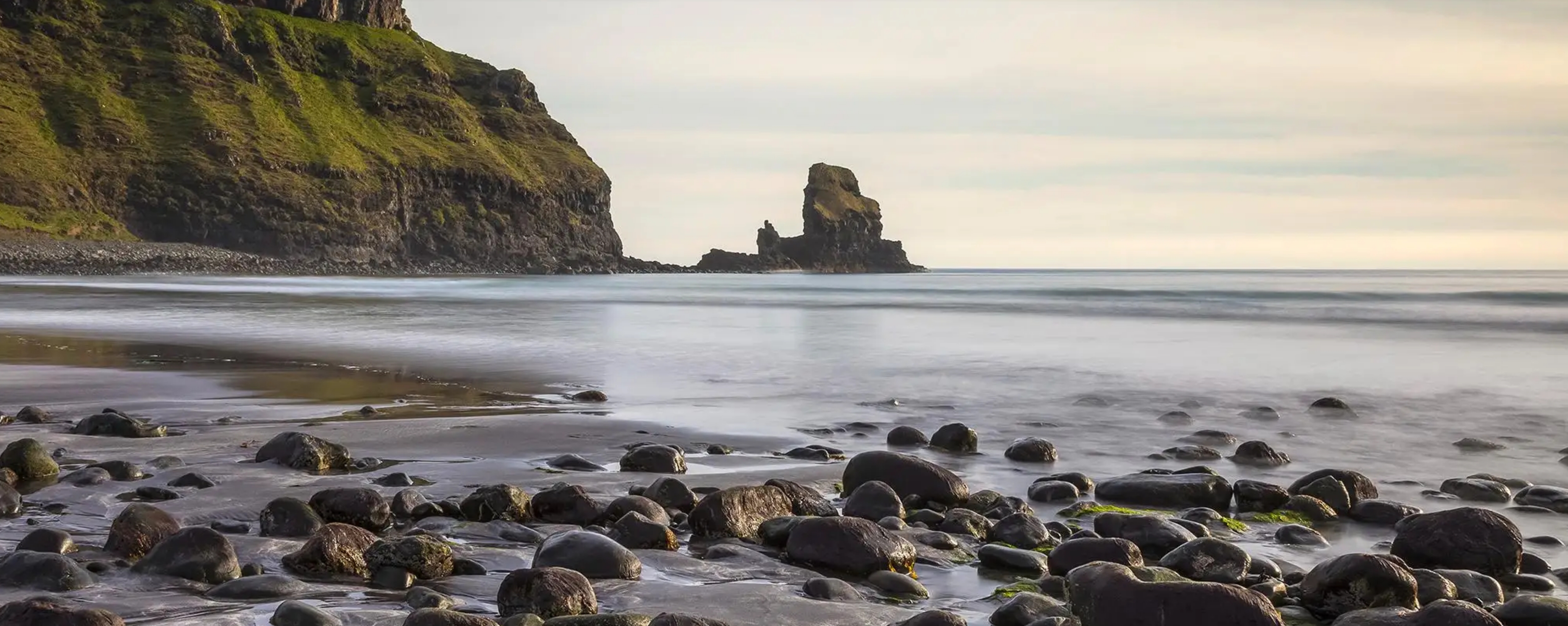
    The Rockies may be majestic, but they are also unforgiving – sheer cliffs, avalanche-prone ridges and deep canyons carved by ancient rivers.

    Map showing the route between Kamloops, Jasper, and Lake Louise or Banff in British Columbia and Alberta.

    Pic by: http://www.rockymountaineer.com

    In the late 1800s, when Canada aimed to unite its provinces from coast to coast, the Canadian Pacific Railway was more than transport; it was nation-building. Engineers blasted tunnels, carved switchbacks and bridged ravines in conditions that would terrify modern workers.

    Barbara-Balvance McLean, the founder of Rocky Mountaineer, revived this heritage in 1990 – but with a bold twist – The train would never travel at night. Why? Because its purpose was not simply arrival. Its purpose was sight, story, experience.

    And this philosophy changes everything.


    Day 1 – Vancouver to Kamloops – Rivers, Salmon, and the Pulse of the Canyon

    We arrived at the platform in Vancouver just after sunrise. A warm towel appeared, followed by coffee and the kind of welcome that feels choreographed but impossibly sincere. We settled into the GoldLeaf dome car, the glass arching overhead like a conservatory of views.

    🥐 Breakfast with the Fraser River

    The first meal set the tone – soft scrambled eggs, local smoked salmon, fresh pastries warmed golden – plated like a boutique hotel brunch.

    Outside, the emerald Fraser River stitched its way through forests of Douglas fir. This is no ordinary river. The Fraser is the lifeblood of the Stó:lō First Nation, who have lived with it for over 10,000 years. The very name Stó:lō means ‘People of the River’. The salmon migrations that fuelled their culture also powered one of the most dramatic engineering decisions of the railroad – pushing the line through Fraser Canyon.

    A group of people engaged in conversation inside a modern, glass-walled train car, showcasing the interior design and large windows.

    Pic by: http://www.rockymountaineer.com

    Pro tip: The most dramatic views of Fraser Canyon and Hell’s Gate are on the left side going eastbound. If you’re travelling westbound (Jasper to Vancouver), request the right side. Hosts will try to accommodate – ask politely at boarding.

    Hell’s Gate – The Earth Squeezes

    Here the river narrows so violently that six times more water surges through the gorge than flows over Niagara Falls. You see it from the train – frothing, furious. It is geology and theatre combined.

    The canyon tells the story of the Ice Age – glaciers retreated, rivers grew violent and bedrock cracked. It is a landscape shaped by erosion, pressure and time, not human ambition – and yet the railway somehow claims a slim ledge along the cliff.

    Wildlife was constant. Bald eagles, perched like sentinels. A hawk spiraling. A fishing boat swallowed by the scale of the canyon.

    By late afternoon, the scenery shifted from conifer forests to sunbaked hills flecked with sage. Kamloops feels frontier-like – ranch land, rodeo culture, dry heat.

    Arrival in Kamloops

    Our luggage disappeared and magically reappeared in our hotel rooms. The Rocky Mountaineer experience is seamless – you don’t drag bags; the staff choreographs your movement like stagehands.

    Day 2 – Kamloops to Jasper – Into the Spine of Canada

    The second morning felt different.

    You could sense elevation increasing, air thinning and mountains rising like watchtowers. The railway climbed into the Rockies through valleys carved by ice over millions of years. Each curve revealed a new visual thesis – granite spires, turquoise rivers, waterfalls tumbling like silk. Mount Robson – The King of the Rockies. Snow shed from the domed glass above us as a hush fell over the carriage.

    Interior of a scenic train with large windows, showing passengers enjoying the view of mountains and forests outside.

    Pic by: http://www.rockymountaineer.com

    Mount Robson, 3,954 metres, is notoriously temperamental. The highest peak in the Canadian Rockies often hides in mist, controlling its own visibility like royalty. We were lucky. The summit appeared, stark and crystalline, shining like a cut gem against blue sky. The hosts called it ‘a blessing’. Indigenous nations believed the mountain was alive – a protector, a boundary, a teacher.

    Rocky Mountaineer trains slow down for wildlife and the views, their conductors trained to respect the ecology and landscapes they pass through.

    Day Trips – Jasper: A Village of Peaks

    Arrival in Jasper was like being dropped into the centre of a snow globe. The town was modest, hemmed by mountains, and its residents – human and otherwise – coexist. Elks walked the streets at dusk. Felt like they owned the pavements (and rightly so) and we merely rent them.

    A scenic view of a tranquil lake surrounded by mountains, with an island of evergreen trees and a boat gliding across the water.

    Pic by: http://www.rockymountaineer.com

    Jasper National Park is a UNESCO World Heritage Site because of its glacier fields, alpine meadows, lakes and wildlife corridors. It is one of the largest protected ecosystems in the Rockies – and it feels like it.

    Pro tip: The train vestibule isn’t just for photos. The temperature drop, the wind, the echo of the rails – those sensory details make the journey visceral. You’ll also spot eagles and mountain goats more clearly without window reflections.

    Day Trips – Columbia Icefield: Walking on Time Itself

    Glacier with snow-covered peaks and rocky terrain under a cloudy sky.

    Pic by: http://www.rockymountaineer.com

    Most glaciers on Earth sit on the shoulders of mountains. The Columbia Icefield sits on the spine of a continent. It is the hydrological apex of North America – a frozen plateau where snowfall compacts into ancient ice, feeding three oceans:

    • The Pacific,
    • The Arctic,
    • and the Atlantic (via Hudson Bay).

    You board a snow coach with tires taller than children. The journey up the moraine is steep, almost lunar. When you step out, the wind tastes like metal and purity.

    ❄️ Your Icefields Story Belongs Here.
    Everyone leaves the Columbia Icefields with a memory – that first crunch of ancient ice underfoot, a laugh shared on the glacier bus or a moment of quiet awe staring at a thousand shades of blue.
    📩 Share yours at editor@wandernests.com or 📸 tag #wandernestsdispatch on Instagram – we might feature it in a future Dispatch. Because the Icefields aren’t just a place to visit – they’re a reminder of how alive our planet still is. 🌍💙

    The glacier as a time machine

    The Athabasca Glacier is thousands of years old. The ice beneath your boots predates human civilisation. Layer upon layer of compressed snow forms dense blue ice, riddled with air bubbles from ancient atmospheres. You are standing on a frozen archive of Earth’s memory.

    But it is also disappearing.

    The glacier has retreated more than 1.5 kilometres since 1890. Markers along the park road show previous boundaries – 1917, 1948, 1982 – each a gravestone in ice.

    A close-up view of a red and white glacier tour vehicle labeled 'GLACIER TOUR ICE EXPLORER' with a Canadian flag logo.

    Pic by www.jaspercolumbiaicefield.com

    We drank from a meltwater stream. It was colder than thought, sharper than emotion – like sipping the beginning of the world.

    Day Trips – Lake Louise: The Colour No Camera Can Explain

    You don’t see Lake Louise.
    You arrive at Lake Louise.

    It is turquoise because glaciers grind bedrock into microscopic particles called glacial flour. Suspended in the water, these particles scatter sunlight, reflecting only blue and green wavelengths.

    A peaceful lake surrounded by mountains with two red canoes resting on a wooden dock.

    Pic by: http://www.rockymountaineer.com

    The lake is named after Princess Louise Caroline Alberta – a symbol of English aristocracy – but to the Stoney Nakoda people, the waters were a mirror to the sky We rented a canoe and drifted across the surface. Nothing moves fast here. The oar enters the water like a whisper. Mountain – reflection – sky – reflection. A conversation between light and ice.

    Yoho National Park – Fossils, Waterfalls, and Awe

    ‘Yoho’ in Cree means ‘Wow‘! It is not poetic exaggeration; it is clinical description.

    This park holds secrets older than the Rockies themselves.

    The Burgess Shale

    High above Yoho Valley lies the Burgess Shale, one of the most important fossil sites in the world. Here scientists uncovered remains from 508 million years ago, during the Cambrian Explosion – when life diversified wildly:

    • animals grew eyes,
    • spines,
    • armour,
    • and strategy.

    It is the birth certificate of modern biology.

    Emerald Lake

    The lake shimmered jade-green because sunlight hit the suspended limestone sediments. You don’t just see Emerald Lake – you walk beside a gemstone.

    A train attendant serving meals to passengers in a dining car, with scenic mountain views visible through the large windows.

    Pic by: http://www.rockymountaineer.com

    Takakkaw Falls

    One of Canada’s tallest waterfalls, plunging 373 metres. Its Cree name means ‘magnificent’ and the air around it is mist and thunder.

    Banff – Where Railroad Dreams Became Luxury Legends

    Banff, like Lake Louise, exists because a railway baron needed people to travel west. The Canadian Pacific Railway executives built grand alpine hotels to tempt European elites – spas, ballrooms, dining salons – luxury in the wilderness.

    A scenic view of a street lined with trees and buildings, with a prominent mountain in the background under a clear blue sky.

    Pic by: http://www.rockymountaineer.com

    The Fairmont Banff Springs, the ‘Castle in the Rockies’, is the crown jewel. It rises from pine forests like a fortress of stone and ambition. Today, Banff hums with boutiques, breweries, mountaineers, and elk strolling through town as if they own it – because they do.

    Why the Rocky Mountaineer Is Not Just a Train

    Aerial view of a train traveling along a river, surrounded by lush green forests and hills.

    It is a theatre of landscapes:

    • glass-domed cars,
    • gourmet kitchens at 60 km/h,
    • sommeliers pouring Okanagan valley wines,
    • hosts who narrate geology, wildlife, history and indigenous heritage.

    It is also a lesson in humility. You cannot conquer the Rockies; you are allowed to pass through them.

    Practical Tips

    Choose GoldLeaf Service – the upper-deck dome and dedicated dining elevate the journey.

    Travel May–September – best wildlife sightings, clearest mountain views.

    Bring binoculars – you will spot eagles, elk, black bears, and mountain goats.

    Layer clothing – indoor comfort, outdoor wind on the viewing deck.

    Let Rocky Mountaineer handle logistics – hotels, luggage and transfers are seamless.

    Final Thoughts

    The Rocky Mountaineer is not the fastest way from Vancouver to Jasper.

    It is the most meaningful.

    It teaches you how to slow down, how to look up and how to appreciate land that was carved by ice and guarded by mountains.

    We boarded expecting scenery. We left with reverence.

    Love travel experiences that leave you awestruck? Explore more unforgettable adventures on Wandernests.

    Craving clever itineraries and offbeat adventures? Subscribe to the Wandernests Dispatch for your weekly dose of wanderlust, whimsy, and where to go next.

  • Walking on Ancient Ice – A Journey to the Columbia Icefields, Canada

    Walking on Ancient Ice – A Journey to the Columbia Icefields, Canada

    Pic by: http://www.parks.canada.ca

    By Wandernests Dispatch – Travel Nest I 16 Oct, 2025

    There are few travel moments that truly take your breath away – standing on a glacier that’s been around for millennia is one of them. The Columbia Icefields, tucked deep in the Canadian Rockies along the Icefields Parkway between Jasper National Park and Banff National Park, was one such moment for us.

    We were there over the summer, as part of a Rocky Mountaineer train journey through Western Canada – a luxurious, slow-travel experience that meanders through cinematic landscapes and mountain towns. One of the highlights of the itinerary, arranged by Brewster Travels (now Pursuit Collection), was a full-day excursion to the legendary Columbia Icefields Adventure – a mix of awe, science and pure thrill on ice.


    What are the Columbia Icefields?

    The Columbia Icefields are the largest ice mass in the Canadian Rockies, feeding six major glaciers – the most famous being the Athabasca Glacier. Spanning over 200 square kilometres and sitting astride the Continental Divide, this vast ice expanse is where meltwater flows into the Pacific, Atlantic and Arctic Oceans – a natural marvel few places on Earth can claim.

    Formed during the last Ice Age, these glaciers have been slowly retreating over the centuries. Today, they’re an unmissable symbol of both nature’s grandeur and fragility – shrinking every year due to climate change.

    A panoramic view of a glacier-covered mountain range under a clear blue sky.

    Pic by: http://www.parks.canada.ca

    To see the Columbia Icefields up close is to witness nature in motion – alive, evolving and quietly slipping away. It’s a place that humbles you, that makes you pause and marvel at how something so immense can also be so fragile. And that sense of wonder stays with you long after you’ve left the Rockies behind.

    ❄️ Your Icefields Story Belongs Here.
    Everyone leaves the Columbia Icefields with a memory – that first crunch of ancient ice underfoot, a laugh shared on the glacier bus or a moment of quiet awe staring at a thousand shades of blue.
    📩 Share yours at editor@wandernests.com or 📸 tag #wandernestsdispatch on Instagram – we might feature it in a future Dispatch. Because the Icefields aren’t just a place to visit – they’re a reminder of how alive our planet still is. 🌍💙

    Pro tip: The best glacier views (and photos) are often just before noon when sunlight hits the ice at an angle – the blues look deeper, and the crowds haven’t quite built up yet.


    The Journey to the Icefields

    The drive itself from Jasper National Park to the Icefields is worth the trip – endless pine forests, turquoise rivers and jagged peaks at every turn. Our coach climbed steadily until the mountains opened up into an otherworldly white expanse. The Columbia Icefields Discovery Centre, perched across from the glacier, serves as the base for all excursions – complete with a restaurant overlooking the ice, a small museum and a short film that beautifully captures the glacier’s past, present and uncertain future (bit more about that later).

    A gourmet dish featuring sliced meat, accompanied by various colorful garnishes and sauces, presented on a round black plate.

    Pic by http://www.banffjaspercollection.com I Lunch at the Altitude Restaurant, Columbia Icefields Discovery Centre

    We began our day here with a hearty lunch at the Altitude Restaurant, watching the sunlight bounce off the glacier while sipping on hot coffee. Afterwards, we headed into the centre’s mini-theatre to catch the short film on the history of the glacier – a stunning piece of cinematography that puts into perspective how ancient and fragile these ice sheets truly are.

    Pro tip: Bring an empty water bottle – you can fill it with pure, icy meltwater straight from the glacier. It’s as crisp and clean as it gets, and makes for a memorable sip of the Rockies.

    Boarding the Ice Explorer

    Soon it was time for the main event. We boarded a massive Ice Explorer bus, designed specifically to handle the steep, slippery slopes of the glacier. Ours was driven by the inimitable Captain Jack – equal parts driver, storyteller and stand-up comic.

    A close-up view of a red and white glacier tour vehicle labeled 'GLACIER TOUR ICE EXPLORER' with a Canadian flag logo.

    Pic by www.jaspercolumbiaicefield.com

    As we rumbled along the rocky terrain and then onto the glacier’s icy surface, Captain Jack kept us entertained with glacier trivia and cheeky humour. The ride itself was both thrilling and nerve-wracking – the kind of slow-motion adventure that makes your heart skip as you descend the steep moraine onto the Athabasca Glacier.

    When the bus finally stopped, we stepped out onto the ancient ice.


    Walking on the Athabasca Glacier

    It’s hard to describe what it feels like to stand on something that’s been around for 10,000 years. The Athabasca Glacier glistens in soft whites and silvers, creaking underfoot as if whispering stories from the Ice Age. The air is crisp and biting cold, even in June. Around us, the silence was profound – broken only by the crunch of boots and the occasional whoop of someone daring a glacier selfie.

    Glacier with snow-covered peaks and rocky terrain under a cloudy sky.

    Pic by www.jaspercolumbiaicefield.com

    We had around 30 minutes on the glacier, enough to walk around, take photographs, and just absorb the immensity of where we were. I remember scooping up a handful of pure glacial water – freezing, fresh and somehow humbling.

    Captain Jack pointed to a distant ridge and told us that, by Year 2100, the glacier might recede almost completely. The lake nearby, he added, was set to disappear within weeks. It was a sobering reminder of how fleeting even the mightiest landscapes can be.


    Beyond the Ice – The Skywalk

    As if walking on ancient ice wasn’t enough, your Icefields Adventure also includes the Glacier Skywalk – a glass-floored walkway jutting out over the Sunwapta Valley. From afar, it looks delicate, almost fragile, but step onto it and you realise it’s an engineering marvel. Suspended 918 feet above a sweeping canyon, offering jaw-dropping panaromic views.

    What strikes you first is the silence – the kind that amplifies every sound. The soft whistle of the wind, the distant rush of waterfalls and the rhythmic crunch of your own footsteps on glass. Beneath you, eagles spiral effortlessly through the valley air, and far below, the Sunwapta River cuts a silver ribbon through ancient rock. It’s as if you’re standing between earth and sky.

    A glass observation deck extending over a mountain cliff with visitors enjoying the view of snow-capped peaks and blue sky.

    Pic by http://www.tourcanadianrockies.com

    Interpretive panels along the walkway tell stories of the Rockies’ geology, wildlife and changing climate – grounding the thrill in meaning. But honestly, it’s the feeling that stays with you – that mix of vertigo, awe and reverence as you realise just how vast and alive these mountains are.

    For those seeking a dash of adrenaline with their awe, the Skywalk is unmissable. Whether you linger for photos or just lean against the glass railing, it offers a rare, humbling perspective – one that makes you feel both incredibly small and deeply connected to the wild beauty of Canada’s high country.


    Why You Should Go

    Visiting the Columbia Icefields isn’t just another sightseeing stop – it’s an encounter with Earth’s ancient history, a moment of connection with something far older and greater than us. It’s also a powerful reminder of how fragile our planet’s ecosystems are.

    A large all-terrain vehicle, labeled 'ICE EXPLORER' and featuring the Canadian flag, parked on a snow-covered landscape with mountains and a glacier in the background.

    Pic by www.jaspercolumbiaicefield.com

    If you’re planning a trip through the Canadian Rockies – perhaps on the Rocky Mountaineer route from Banff or Jasper – make sure to include this excursion. It’s a once-in-a-lifetime experience that combines science, scenery and storytelling.

    And while you’re crafting your Canada itinerary, consider pairing this icy adventure with something completely different – the Calgary Stampede, the world’s greatest outdoor rodeo and a riot of cowboy culture and carnival fun. We did both on the same trip, and the contrast – from glacier chill to rodeo heat – made it unforgettable.

    Practical Tips

    Best time to visit: May to early October, when glacier access roads and tours are open.

    What to wear: Layers, waterproof shoes, sunglasses (the glare is intense).

    Book ahead: Tours via Brewster/ Pursuit often sell out during summer.

    Duration: Half a day, including transfer, film, glacier ride and optional Skywalk.

    Don’t miss: The Discovery Centre restaurant for that iconic glacier view over lunch. Spring (April – May) and Autumn (Sept – Oct) bring fewer crowds, lots of drama in the skies and fewer midges.

    Final Thoughts

    Even years later, we can still recall the feeling of that crisp, thin air and the dazzling blue veins of ice beneath our boots. The Columbia Icefields are more than a stop on the map – they’re a humbling journey into the heart of the Rockies, where nature’s power and vulnerability stand side by side.

    So if you ever find yourself crossing the Icefields Parkway, don’t just drive past. Stop. Step out. Walk on ancient ice. It might just be the most unforgettable step you take in Canada.

    Love travel experiences that leave you awestruck? Explore more unforgettable adventures on Wandernests.

    Craving clever itineraries and offbeat adventures? Subscribe to the Wandernests Dispatch for your weekly dose of wanderlust, whimsy, and where to go next.

  • A 6 Day Scottish Highlands & Isle of Skye Itinerary: Castles, Cliffs and Ceilidhs Over Easter

    A 6 Day Scottish Highlands & Isle of Skye Itinerary: Castles, Cliffs and Ceilidhs Over Easter

    Pic by: http://www.visitscotland.com

    By Wandernests Dispatch – Travel Nest I 8 Sept, 2025

    The Isle of Skye. Just saying the name feels like a spell. A rugged island off Scotland’s west coast, Skye is a place of mist shrouded mountains, fairy folklore and clan castles clinging to cliffs. Its Gaelic name, An t-Eilean Sgitheanach (‘the winged isle’), nods to its jagged peninsulas that stretch like feathers into the sea. For centuries, it has been the backdrop to battles, legends and bardic poetry – and today, planning an Isle of Skye itinerary is on almost every traveller’s bucket list.

    But no trip to Skye is complete without passing through Inverness, the ‘capital of the Highlands’. Perched on the River Ness, Inverness is where you feel the heartbeat of Highland history – from Pictish kings to Jacobite rebellions. Making it the perfect starting point for our Easter road trip this summer.

    And if you ever want to test your friendships, rent a car and drive through the Scottish Highlands for a week. Luckily, our group of four (two couples, one shared obsession with Thermos tea) survived the trip with our sanity, wallets and waistlines mostly intact. What we gained was a memorable six days of castles, whisky, waterfalls and enough dramatic landscapes to make your phone storage weep and Outlander look tame.

    Here’s how our six day Isle of Skye itinerary adventure unfolded.


    Day 1: Inverness – Culloden & the Last Battle on British Soil

    After landing in Inverness and grabbing our rental car, we headed straight to Culloden Battlefield – and trust us, it’s not just ‘a field’. On 16 April 1746, this moor was the site of the last pitched battle fought on British soil. Bonnie Prince Charlie led the Jacobite army, largely composed of Highland clans, against the forces of the Hanoverian government. It was a brutal, one-hour clash that crushed the Jacobite cause and changed Highland life forever.

    Walking the windswept moor, with clan stones marking where MacDonalds, Frasers, Camerons and Macintoshes fell, is profoundly moving. The visitor centre pulls no punches either – think immersive battle simulations and artefacts that remind you these were real men. Fighting for faith, family and a doomed dream of restoring the Stuarts.

    A large stone with inscriptions in a grassy field, surrounded by smaller stones and a pathway, under a cloudy sky.

    Pic by: http://www.nts.org.uk I Culloden Battlefield, Inverness

    We left reflective but grateful, ending the day with hearty Highland fare back in Inverness and an early night. Easter weekend had only just begun.

    🌄 Your Skye & Highlands Story Belongs Here.
    Everyone leaves the Isle of Skye with a tale – a misty Quiraing hike, a sheep stand-off or a dram of Talisker by the sea.
    📩 Share yours at editor@wandernests.com or 📸 tag #wandernestsdispatch on Instagram – we might feature it in a future Dispatch.
    Because Skye isn’t just a trip, it’s a story waiting to be told. 🫖🌍

    Pro tip: Do not skip the visitor centre – it’s brilliantly immersive and the perfect way to set the tone for the Highlands.


    Day 2: All Aboard the Jacobite Express – Hogwarts Meets Highland History

    We boarded the Jacobite Steam Train in Fort William – and yes, this is the train made famous by the Harry Potter films as the Hogwarts Express. But even without the wizardry, the journey is spellbinding. The train snakes past lochs, glens and the Glenfinnan Viaduct, an engineering marvel of the Victorian age.

    Historically, Glenfinnan is even more important than Potter trivia. It was here in 1745 that Bonnie Prince Charlie first raised his standard, rallying clans to the doomed Jacobite rising. Standing at the monument today, you can almost hear the bagpipes and feel the weight of history.

    After a quick wander in the fishing port of Mallaig, we returned via scenic roads back to Inverness – sheep, lochs and sweeping glens making the miles fly by.

    A steam train traveling over a stone viaduct in a lush green landscape.

    Pic by: http://www.jacobitetrail.co.uk I Glenfinnan Viaduct & Jacobite Steam Train

    Driving through these tunnels (many of which are tolled) is part of the experience. It gives you a front-row seat to how this island nation has engineered its way through dramatic natural barriers.

    Pro tip: Book your steam train tickets well in advance – they were nearly sold out when we booked ours, well over 3 months in advance!

    Day 3: Into Skye – Fairy Pools & the Cuillin’s Legends

    Crossing the Skye Bridge felt like stepping into another world. Our first stop – the Fairy Pools, crystal-clear waterfalls tumbling down from the Black Cuillin mountains and fed by ancient volcanic rock formations. According to local legend, fairies once bathed here and the waters are said to hold mystical powers. (We bravely decided to keep our socks on – hypothermia isn’t our thing!).

    A scenic view of a green valley surrounded by mountains under a cloudy sky.

    Pic by http://www.dunvegancastle.com I The Fairy Pools, Isle of Skye

    By evening we rolled into Portree, a harbour town painted in pastel colours. It was the perfect base for our adventures and the jumping off point for our Isle of Skye itinerary. Portree’s pastel houses make it postcard-perfect, but historically it was a fishing hub and, briefly, Bonnie Prince Charlie’s hiding spot after Culloden. Today, it’s where every traveller ends up because it has the only big Co-op on the island. Naturally, we joined the pilgrimage, stacking up groceries like Victorian explorers provisioning for a month at sea. Why? Because our cabin was 20km out in the wilderness. Once we drove out there, surrounded by nothing but sheep and sky, we realised – yes, this was remote, but it was also exactly why we’d come.


    Day 4: Skye’s Greatest Hits – Quiraing, Kilt Rock & Fairy Glen

    Skye is basically Mother Nature’s show-off cousin – it goes straight for the dramatic. We started the day with the Old Man of Storr, a towering pinnacle of rock created by an ancient landslide. This is also the number one hike in any Isle of Skye itinerary. Legend says it’s the thumb of a giant buried in the earth, sticking out to remind us he’s still there. The hike is steep in parts, but every step rewards you with views over the Sound of Raasay that make you forget how hard your legs are working.

    Scenic view of rugged rock formations with a lake and mountains in the background.

    Pic by http://www.isleofskye.com I Old Man of Storr Hike, Isle of Skye

    From there, we drove to the Quiraing, a dramatic landslip on the Trotternish Ridge, feels otherworldly. Formed by ancient volcanic activity, hiking here feels like you’ve wandered into a fantasy film set. Jagged cliffs, hidden plateaus and views that make you question whether your camera can cope.

    A winding road through vibrant green hills and rugged cliffs in a scenic landscape.

    Pic by http://www.isleofskye.com I Quiraing, Isle of Skye

    Next stop was a 10min drive down the road to Kilt Rock & Mealt Falls. Basalt columns shaped like the pleats of a kilt tumble into the sea, complete with a waterfall that looks like it’s staging its own photoshoot.

    And then the Fairy Glen – miniature grassy mounds and spirals that look suspiciously like the work of mischievous fairy folk. Some say the patterns were carved by sheep; others swear it’s magic. Either way, it’s the kind of place where grown adults (yes, us) end up clambering around like kids.

    We ended the day back in Portree, legs sore, spirits high and whisky levels suitably replenished.


    Day 5: Clan Strongholds, Talisker Distillery, Coral Beaches & Neist Point

    No trip to Skye is complete without Dunvegan Castle, home of Clan MacLeod for 800 years. Inside, treasures like the Fairy Flag – a talisman said to protect the clan in battle – connect myth and history. Outside, the gardens explode with spring colours, reminding you that Scotland can do softness as well as sternness.

    A scenic view of a castle surrounded by lush greenery and a calm body of water.

    Pic by http://www.dunvegancastle.com I Dunvegan Castle, Isle of Skye

    From there, we headed straight to Talisker Distillery in Carbost – the oldest working distillery on Skye, founded in 1830. Perched on the shores of Loch Harport, Talisker has been producing its smoky, peaty, sea-salt-tinged whisky for nearly two centuries. The tour was brilliant: a mix of history, craftsmanship and the kind of warm storytelling only whisky makers can pull off. The tasting at the end was a revelation – fiery yet smooth, like drinking the very essence of Skye’s rugged coastline.

    Image of the Talisker distillery located near a body of water, surrounded by green hills under a cloudy sky.

    Pic by http://www.visitscotland.com I Talisker Distillery, Isle of Skye

    From there, we drove to Coral Beach. Despite the Caribbean vibes of its white ‘sand’ (actually crushed seaweed) and turquoise water, the wind was a sharp reminder we were still very much in Scotland.

    Our final stop – Neist Point, Skye’s westernmost tip and home to a lighthouse perched on dramatic cliffs. Built in 1909, it’s one of Scotland’s most photographed spots. And standing there with the wind whipping around us, we understood why. If ever a place screamed ‘Highland epic’, this was it.


    Day 6: Farewell Skye – Eilean Donan & Back to Inverness

    On our way back to Inverness, we stopped at Eilean Donan Castle. Perched on its own little island, this 13th century fortress was once a stronghold against Viking raids and later a base for Jacobite uprisings. Today, it’s the kind of castle you expect to see in a film – which is apt, since it’s starred in plenty, from Highlander to James Bond.

    Aerial view of a castle situated on an island surrounded by water and mountains in the background.

    Pic by http://www.eileandonancastle.com I Eilean Donan Castle, Isle of Skye

    After soaking it all in, we returned our car in Inverness and caught our flight home. Cameras bursting, hearts full and a sense that Scotland had given us both a holiday and a history lesson.

    Practical Tips

    When to go: Spring (April – May) and Autumn (Sept – Oct) bring fewer crowds, lots of drama in the skies and fewer midges.

    Driving: Expect single track roads, sheep stand-offs, and views so distracting they’re borderline dangerous.

    Food: Book ahead in Portree – even out of season, tables (and cottages) disappear fast.

    Whisky lovers: A stop at Talisker Distillery is mandatory.

    Final Thoughts – Hiking in the Faroe Islands is Pure Magic

    The Highlands and Skye aren’t just places you visit – they’re places you feel. Every mountain carries a legend, every ruin whispers of clans and rebellions, every loch hides stories deeper than the water.

    Our Easter road trip gave us castles and cliffs, myths and markets, whisky and weather tantrums. We left with full memory cards, heavier bags (thank you, Co-op) and the kind of shared stories you retell for years.

    Would I recommend this 6-day Inverness and Isle of Skye itinerary? Without hesitation. Just bring waterproofs, patience for single-track roads and at least one friend willing to make tea in a Thermos.

    Love travel experiences like this?

    Craving clever itineraries and offbeat adventures? Subscribe to the Wandernests Dispatch for your weekly dose of wanderlust, whimsy, and where to go next.

  • Faroe Islands: The Remote Nordic Hiking Paradise You’ve Never Heard Of

    Faroe Islands: The Remote Nordic Hiking Paradise You’ve Never Heard Of

    Pic by: http://www.lonelyplanet.com

    By Wandernests Dispatch – Travel Nest I 19 Aug, 2025

    Tucked between Iceland and Norway in the North Atlantic Ocean, the Faroe Islands are an untouched, wind-swept gem. The archipelago is made up of 18 volcanic islands, linked by tunnels, ferries, and legends. The Faroes are a self-governing part of the Kingdom of Denmark. They are best known for their dramatic cliffs, ever-changing skies, and a sheep-to-human ratio of 8:1. Yes – the sheep rule here.

    For hiking enthusiasts, the Faroe Islands are a dream. Rugged coastal paths, bird cliffs, waterfall trails await. Ridge-top hikes deliver views that defy belief. Every day here feels like a scene out of a Nordic saga. In May, the spring fog lifts and wildflowers peek through the mossy ground. The islands feel both desolate and divine.

    We designed our week-long holiday itinerary to chase this very experience. Read on for our trail-tested adventure. It’s perfect for hikers craving cinematic views and zero crowds.


    Getting to the Faroe Islands from the UK – Flights, Ferries & FaroeJet

    Reaching the Faroe Islands feels like the start of an adventure in itself. These remote isles are not yet overrun with tourists, so while flights are limited, they’re manageable with a bit of planning.

    From London, you have a few good options:

    London – Copenhagen – Vágar
    This is the most common route. Fly from London Heathrow or Gatwick to Copenhagen, and from there take a connecting flight with Atlantic Airways – the national carrier of the Faroe Islands – to Vágar Airport (FAE).

    London – Edinburgh/ Aberdeen – Vágar
    During summer months, there are also seasonal direct flights with Atlantic Airways from Edinburgh or Aberdeen, making it a more direct hop across the North Atlantic.

    Alternative – Ferry from Denmark
    If you’re feeling adventurous (and patient), you could also take a car ferry from Hirtshals, Denmark, to Tórshavn, the capital – but this journey takes over 36 hours and is only for the truly slow-travel inclined.

    A panoramic view of rugged mountains and cliffs overlooking the ocean during sunset, with dramatic clouds and a green landscape.

    Pic by: http://www.faroeislands.fo

    🌍 Your Faroese Hiking Tale Awaits.
    Every hiker leaves the Faroe Islands with a story etched in wind and stone. Maybe it was the moment Lake Sørvágsvatn floated above the ocean, the heart-pounding climb up Slættaratindur or the first glimpse of Múlafossur Waterfall tumbling into the sea.

    🥾 Did you have your own summit high, puffin encounter, or cliff-top picnic with only sheep for company? We’d love to hear it.

    📩 Write to us at editor@wandernests.com, or 📸 share your snaps on Instagram with #wandernestsdispatch – we might feature your story in a future Wandernests Dispatch.

    Because the Faroes aren’t just a destination – they’re a tale waiting to be told and we’d love to trade yours over mist, mountains and maybe a little thermos tea. 🫖


    Car Hire is Non-Negotiable in the Faroes

    Once you land in Vágar, renting a car is essential. The Faroe Islands consist of 18 volcanic islands. Many are rugged, remote and sparsely populated. Public transport is minimal and infrequent. Guided tours can’t match the flexibility you need, especially as a hiker or explorer.

    Tunnels That Changed Everything

    The Faroese have solved the challenge of connectivity with a feat of engineering brilliance – a network of undersea tunnels linking the major islands. The most famous is the Eysturoyartunnilin, an 11km long subsea tunnel with the world’s only undersea roundabout – yes, a roundabout beneath the Atlantic! It connects Streymoy, Eysturoy, and Runavík, slashing travel time and making road-tripping easier than ever.

    A colorful tunnel with illuminated artwork featuring silhouettes against a gradient of blue, green, and red lighting.

    Pic courtesy The Eysturoyartunnilin I http://www.guidetofaroeislands.fo

    Driving through these tunnels (many of which are tolled) is part of the experience – it gives you a front-row seat to how this island nation has engineered its way through dramatic natural barriers.

    Day 1 – Arrival & Into the Wild

    Our Faroese adventure began in Tórshavn, the pint-sized capital full of charm. With just over 13,000 residents, it’s often called the smallest capital city in the world. What it lacks in size, it makes up for in character. Picture black-tarred cottages with turf roofs, winding alleyways, and cosy cafés. Down at the harbour, fishing boats bob gently in the breeze.

    We based ourselves at the Hilton Garden Inn Faroe Islands. This sleek, modern hotel sits on a gentle hill in the Ona district, just a short walk from Tórshavn’s town centre. From its elevated position, you get sweeping views across the surrounding fjords. On clear days, the ocean sparkles in the distance. It’s one of the best hotels in the country. Expect minimalist Nordic design, hearty Faroese breakfasts and warm hospitality that makes you feel at home.

    A modern building with multiple floors illuminated at night, featuring large windows and a sloped roof, set against a cloudy sky.

    Pic by http://www.tripadvisor.co.uk I Hilton Hotel Faroe Islands

    After landing at Vágar Airport via Copenhagen, we picked up our rental car – essential for island-hopping. From here, it’s a scenic 45-minute drive to Tórshavn. Driving here feels surreal. There’s no traffic, just open roads hugging cliffs. Waterfalls tumble beside the road, and grass-roofed homes dot the landscape. Stock up on essentials at the local supermarket – they close early, especially on Sundays. Then stroll into the old town for a seafood dinner and breathe in the briny Atlantic air. That first Faroese sunset was wild, windy and golden. It’s a memory that will stay with you long after you leave.


    Day 2 – Saksun to Tjørnuvík to Fossa – North Streymoy’s Classic Duo

    Our first full day of hiking began with a drive through winding mountain roads. We arrived in Saksun, a village so tucked away it feels like a secret. Saksun sits in a glacial amphitheatre. It is home to just a handful of turf-roofed houses, a tiny white church, and a tidal lagoon of black volcanic sand. When the tide is out, the lagoon stretches toward the sea like an otherworldly runway. Towering green cliffs frame the view.

    From here, we picked up the coastal trail to Tjørnuvík. It is the northernmost village on Streymoy Island. The 7km hike followed undulating grass paths. The Atlantic lay on one side and dramatic cliff faces on the other. The soundtrack? The wind in our ears, the crunch of boots on moss, and the comic baaing of the resident sheep.

    A picturesque view of a small white church nestled among lush green hills and steep rocky mountains under a cloudy sky.

    Pic by http://www.guidetofaroeislands.fo I Saksun, Faroe Islands

    As Tjørnuvík came into view, the silhouettes of Risin og Kellingin – the Giant and the Witch – rose from the sea. Local legend says these towering sea stacks are a petrified pair, frozen forever in stone while trying to drag the Faroe Islands back to Iceland. Seeing them loom against the horizon felt like stepping into a Norse myth.

    We capped off the day with a detour to Fossa Waterfall, the tallest in the Faroes. Cascading in two tiers straight from the mountains into the sea, its sheer scale makes you feel wonderfully small. Standing there, mist on our faces, was the perfect finale to a day already bursting with wild beauty.


    Day 3 – Kalsoy Island & the Kallur Lighthouse – Hiking to the Edge of the World

    No hiking trip to the Faroes is complete without standing at the windswept tip of Kallur Lighthouse – a place so cinematic it became the final backdrop in James Bond – No Time to Die. It’s that dramatic, although getting there is an adventure in itself.

    From Klaksvík, we boarded a small car ferry to Kalsoy Island, nicknamed the flute for its long, narrow shape and series of tunnels bored through its spine. The road hugs sheer drops and passes villages where turf-roofed homes huddle against the wind, as if bracing for centuries of storms.

    Aerial view of a dramatic cliffside landscape with lush green hills and a rugged shoreline meeting a dark ocean, partially shrouded in mist.

    Pic by http://www.guidetofaroeislands.fo I Views from Kallur Lighthouse, Faroe Islands

    The trail to Kallur starts innocuously enough near the village of Trøllanes – but don’t expect a neat, signposted path. The route is a farmer’s field, and access comes with a small toll payable to the landowner. From there, it’s a steep climb over uneven grass, often slick with mist, before the ridge flattens into a long, exposed plateau. With no clear track, you follow sheep trods and the distant glimmer of the lighthouse itself.

    And then – there it is. Kallur Lighthouse, perched precariously on a narrow finger of land, with cliffs plunging hundreds of metres into the Atlantic on either side. Behind you, jagged fjords stretch endlessly; in front, the ocean feels infinite. On a clear day, you can see as far as the neighbouring islands. On a foggy one, the whole world feels reduced to you, the lighthouse and the wind.

    It’s a hike that combines physical grit with sheer awe and one you’ll carry in memory long after you’ve left the Faroes.


    Day 4 – Hestur Island via RIB62 and Eysturoy’s Highs

    The day began not on foot, but on the water – with a heart-thumping RIB62 boat tour to Hestur Island. Skimming across the glassy surface of the fjord at speed, we closed in on towering cliffs alive with seabirds. Sheer walls of volcanic rock loomed above us, streaked with moss and echoing with the cries of puffins, guillemots, and fulmars. At times, the boat nosed into sea caves so deep they swallowed the daylight, the water glowing an otherworldly green under the hull. It was a rare view of the Faroes few hikers get to see and it left us grinning like kids.

    A scenic view of rugged cliffs and a coastline with the ocean in the foreground, featuring a bird flying near the rocky shore.

    Pic by http://www.rexby.com I Hestur Island, Faroe Islands

    After lunch, we swapped sea spray for summit winds and set out to conquer Slættaratindur, the tallest mountain in the Faroe Islands at 880 metres. The climb is not technical – no ropes or scrambling – but it is relentless: steep, grassy slopes that test your calves and make you grateful for every pause to catch your breath. Sheep stare in mild amusement as you zig-zag upwards.

    At the summit, the reward is staggering. On a clear day, you can see almost the entire Faroese archipelago laid out like a topographical map, with its fjords and islands stitched together by undersea tunnels and shimmering stretches of ocean. And far on the horizon, faint but magical – you may even glimpse Iceland.

    The descent is almost as demanding as the climb, your knees feeling every metre. But relief comes in the form of Gjógv, a postcard-perfect village named after its natural sea gorge. We ended the day here, watching waves swirl into the narrow channel, pastel houses glowing under the soft evening light.

    Day 5 – The Lake Above the Ocean – Trælanípa and Bøsdalafossur

    If we had to choose one hike that captures the surreal magic of the Faroes, it would be the Trælanípa trail – a walk where the land plays tricks on the eyes. Starting just outside Miðvágur, the 3 km path is gentle enough to lull you into a steady rhythm, winding through windswept grassland with sheep as your silent companions.

    Then, without warning, the famous optical illusion unfolds – Lake Sørvágsvatn appears to hover hundreds of metres above the Atlantic Ocean. In reality, the lake sits on a steep cliff, but from this vantage point, it seems suspended in mid-air, a shimmering mirror cupped by grassy ridges. The Faroese name it Leitisvatn, but most visitors simply call it the lake above the ocean.

    A panoramic view of a dramatic cliffside overlooking a serene lake surrounded by lush green hills under a cloudy sky.

    Pic by http://www.guidetofaroeislands.fo I Lake Above the Ocean, Faroe Islands

    Following the cliff edge, we reached Bøsdalafossur, where the lake’s fresh water spills directly into the saltwater of the Atlantic in a single, defiant leap. The wind here is relentless – gusts tug at your jacket, the roar of water and waves merging into one wild soundtrack.

    We closed the day in Gásadalur, a tiny hamlet once only accessible by hiking over a mountain. Today, a tunnel links it to the rest of Vágar Island, but it still feels tucked away from time. Here, the Múlafossur Waterfall drops straight from a grassy cliff into the ocean, framed by mountains that seem to guard the village. Standing there, with sea spray on our faces and the Atlantic stretching endlessly beyond, it felt like the Faroes were giving us their postcard-perfect farewell.

    Day 6 – Souvenir Strolls and Sad Goodbyes

    Our final morning was unhurried, a gentle exhale after days of wind, cliffs, and summits. We wandered the cobbled streets of Tórshavn, peeking into small boutiques selling Faroese knitwear, ceramics and handcrafted keepsakes – pieces of the islands you can carry home. The harbour bustled softly with fishing boats and seabirds, as if going about their own quiet routines.

    Narrow cobblestone pathway between traditional red wooden houses with grass-covered roofs, creating a picturesque village scene.

    Pic by http://www.guidetofaroeislands.fo I Tinganes Area, Torshavn, Faroe Islands

    With time for one last stroll through the old town, we paused to take in the details we’d grown to love – turf roofs beaded with dew, the smell of salt and grass in the air, and the way the light shifted so quickly that every corner felt like a new photograph.

    Our legs were pleasantly sore, our memory cards full, and our hearts brimming with moments – fog-laced ridges, waterfalls tumbling into the sea and the constant companionship of sheep. The Faroe Islands had not just delivered on our hiking hopes – they’d exceeded them in every way, leaving us with that rare mix of awe and longing that only the most special places can give.

    Final Thoughts – Hiking in the Faroe Islands is Pure Magic

    From misty peaks to ocean-carved cliffs, the Faroe Islands offer hikes unlike anywhere else in the world. It’s a place where silence roars, sheep outnumber people, and every trail feels like a secret. If you’re seeking a remote hiking escape that leaves you breathless – in both scenery and solitude – the Faroes are your next adventure.

    Love travel experiences like this?

    Craving clever itineraries and offbeat adventures? Subscribe to the Wandernests Dispatch for your weekly dose of wanderlust, whimsy, and where to go next.

Don’t miss these awesome reads - subscribe today!